Introduction / Home
Process (short)
More Process Details
Notes on JOSM Files
PicLayer Files
Territory Examples
AN149
PE007
Ridges & Settings
Spread & Cliffs
Granularity & Roughness
Ridge Rounding
Other Objects
LakesFlats
Custom Objects
Miscellaneous
Current Issues
Possible Projects
Fractal Noise
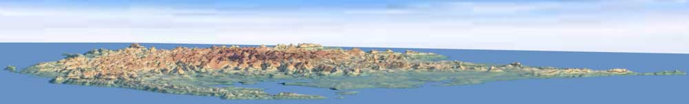
PE007: A small island with relatively flat topography, rendered at a much smaller scale.
| Location: https://opengeofiction.net/#map=10/-0.4896/-144.6542&layers=B | |
 |
|
OSM File: PE007.osm |
|
| Decimal Elevation Data (CSV): PE007-decimalNumbers.ele.csv (17.8 MB) | |
| Whole Number Elevation Data (CSV): PE007-wholeNumbers.ele.csv (4.6 MB) | |
| Gray-scale Height-map: PE007-Gray.png | |
| mapWidth = 1314 px mapHeight = 1359 px minLat = -0.66609511479 minLon = -144.8762465055 maxLat = -0.29993405066 maxLon = -144.52231859488 |
|
| Render scale: 30m² / px | |
| Nodes: ~ 1600 | |
| Ways: ~350 | |
| Render Time: ~11 minutes | |


